 |
| PARKER DAM WAS BUILT AT A NARROW POINT IN THE VOLCANIC ROCKS |
 |
| COLORADO RIVER TRENCH AT PARKER STRIP |
Most people in Colorado are probably unaware that the Arizona-California border is the Colorado River where numerous dams back up large lakes. Arizonians refer to the area as the West Coast. Starting near Las Vegas with Lake Mead and Hoover Dam, the river has cut several deep canyons on the way south to Yuma, AZ and ultimately to its delta in the Gulf of California. At times in the recent past the river actually emptied into the Salton Sea to the west of the current trench, an area created by faulting associated with the San Andreas Fault. Now the river does not actually reach the Gulf as water is diverted off for irrigation and culinary use, evaporation rates are high, and the delta has blocked the channel.
Lake Mohave, about 65 miles in length, is downstream from Hoover Dam and behind Davis Dam. Parker Dam backs up Lake Havasu for 45 miles and is the source for both southern California drinking water (Colorado River Aqueduct) and the Phoenix metro area (Central Arizona Project). Following those dams are the Palo Verde and Imperial dams.
I was amazed that the river near Parker, Arizona, (about midway on the border) is crystal clear and quite deep. Geologists still are uncertain about the exact age of the lower Colorado River and the formation of the Grand Canyon (you will see figures ranging from 65 Ma to about 5 Ma). What is known is that the river turns south near Vegas, cuts through mountain ranges, creates some fairly deep canyons, and pretty much runs in a straight line to the Gulf. The path was at least partially determined by a series of faults and down-dropped basins here in the Basin and Range Physiographic Province.
At one time geologists believed the Gulf of California extended north nearly to Las Vegas and that the Colorado River simply keep cutting and following its retreat to the current location. The evidence for this was the late Tertiary Bouse Formation, which in its lower reaches contains marine invertebrates.
Jon Spencer and Philip Pearthree of the Arizona Geological Survey have produced a great story of the Colorado River evolution in the Winter 2005 edition of Arizona Geology (http://www.azgs.state.az.us/), and the following summary is from that article: Geologists now believe that the Bouse Formation was deposited by the Colorado River in a series of lakes that filled with river water and spilled over, eventually linking the river with the Gulf of California. At the mouth of the Grand Canyon, the Colorado River first arrived less than 6 million years ago. Along the course of the lower Colorado River, it appears that all of the Bouse Formation was deposited between 5.5 and 5.3 million years ago and Colorado River sands arrived in the Salton Trough less than two hundred thousand years after deep flooding of Mohave Valley. The influx of Colorado River water and sediment at this time marks the inception of the modern Colorado River. The modern Grand Canyon began with spillover of a very large lake in northeastern Arizona and rapid incision of the lake outflow point about 5.5 million years ago.
As for the marine invertebrates, recent studies show that evaporation in the southernmost lake as it was filling with river water (the only location for the fossils) could have elevated the salinity to sea-water levels. Most likely birds transported the initial organisms to the inland waters.
I have been camped here at Buckskin State Park on the “Parker Strip” for a couple of weeks and have been exploring the geology. It is complex, especially for a short-time visitor like me. The rocks range in age from Precambrian crystalline to Paleozoic limestones to huge amounts of Tertiary volcanics to the sedimentary Bouse Formation and other basin-fill sediments to Quaternary gravels. There are the lower plates rocks and the upper plate rocks and the detachment faults and the normal faults and the thousands of feet of sediments associated with the river that fill all of these paleovalleys along with the overlying terrace deposits. It is a “jumbled mess” and I certainly appreciate the skill of the mapping geologists.
mike
 | ||
| THE PINNACLE OF TOURIST SLEAZE--LONDON BRIDGE |
 |
| VOLCANIC AGGLOMERATE |
 |
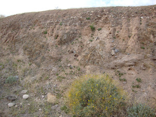
| BASIN FILL SEDIMENTS AND SEDIMENTARY ROCKS |
 |
| VIEW FROM THE EASY CHAIR |
 |
| AT SOME LOCALITIES SAND HAS BLOWN FROM THE RIVER BED AND SANDBARS (PRE-DAM DAYS) AND CREATED DUNE FIELDS |
No comments:
Post a Comment